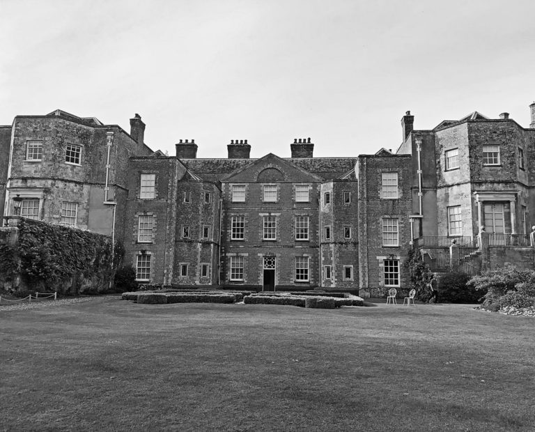
High Definition Scan for Mottisfont Abbey
Heinrich and Palmer View project
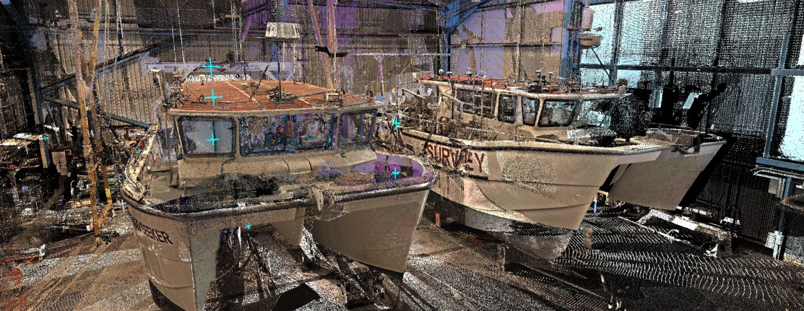
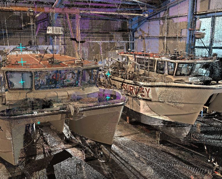
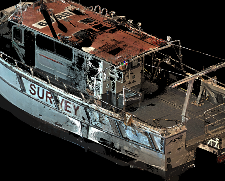
Bolstering our ever growing list of successful laser scans, GEOSIGHT undertook a high definition laser scan of two vessels for the purpose of Vessel Information Modelling (VIM).
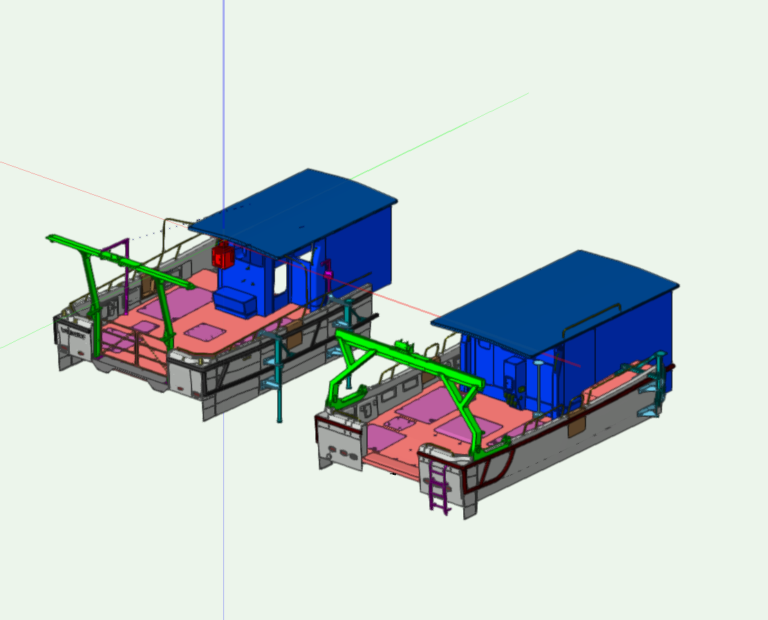
The client had requested two vessels in their fleet to be modelled for the purpose of asset management and future refit functionality.
In order to complete the scans, GEOSIGHT used a Leica P40 Laser Scanner for the external and main structure of the two vessels, whilst the internal and hard to reach areas were captured by a Leica BLK360 laser scanner.
For the VIM process, first we used Leica Cyclone to register the clouds and attached the data to the vessel reference frame. We then used a combination of 3DReshaper and AutoCAD to extract components from the point cloud to provide a complete model for delivery.
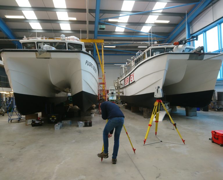
The VIM process was completed alongside a dimensional control survey on one of the vessels. The highly detailed scan data proved to be a valuable asset when it came to calculating the position of some of the more intricate sensors.
Service: High Definition Laser Scan / VIM
Purpose of Survey: Asset Management
Client: N/A
Environment: Shipyard Warehouse
Location: United Kingdom
Year: 2019
Timescale: 2 days on site
Equipment: Leica P40 Laser Scanner, Leica BLK360 Laser Scanner, Leica TS16 Total Station
Output: Unified Point Cloud, .dwg Model