Why GEOBASE?
GEOBASE aims to equip an individual with the theoretical and practical knowledge required to plan, undertake and report a vessel dimensional control survey. The course contents are aligned to guidance from professional surveying bodies and cover vessel dimensional control survey practices used on vessels engaged in nautical charting and the offshore energy industry.
The course includes land and hydrographic surveying principles which underpin the conduct of a vessel dimensional control survey
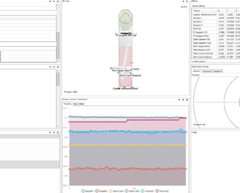
GEOBASE initially guides you through the best practices process of carrying out a vessel dimension control survey and the population of the offsets into GEOBASE.
GEOBASE then guides you through the calibration of attitude sensors and Gyro’s, providing the surveyor with automated calibration routines specific to the sensors being used and the common reference frame chosen for alignment.
GEOBASE assists the surveyor through the process of carrying out an independent static navigation verification and the input of data into GEOBASE, which will then provide automated results which provide verification of both the GNSS position and the previously calculated attitude and heading sensor alignment values.
GEOBASE demonstration video