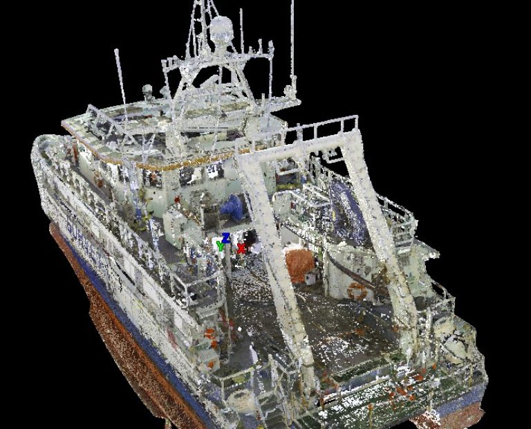
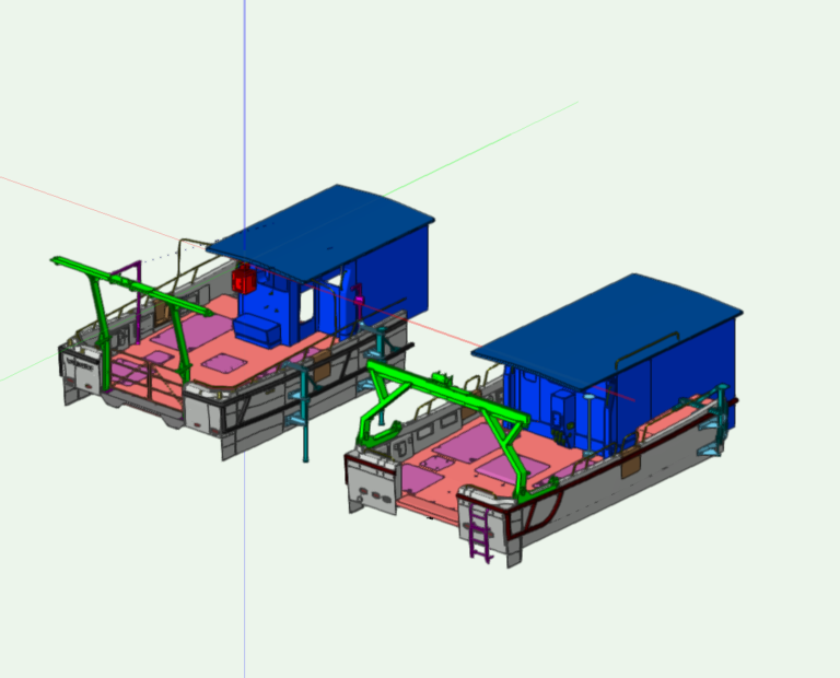
Recent technological advances have led to a huge uptake in the desire for accurate meshing and modelling of ships. The challenge? - To scale up metrology grade scanning to map every weld seam and dent both externally and internally onto something far larger than the instruments were designed for.
3D Laser Scan Surveys / Vessel Information Modelling (VIM)
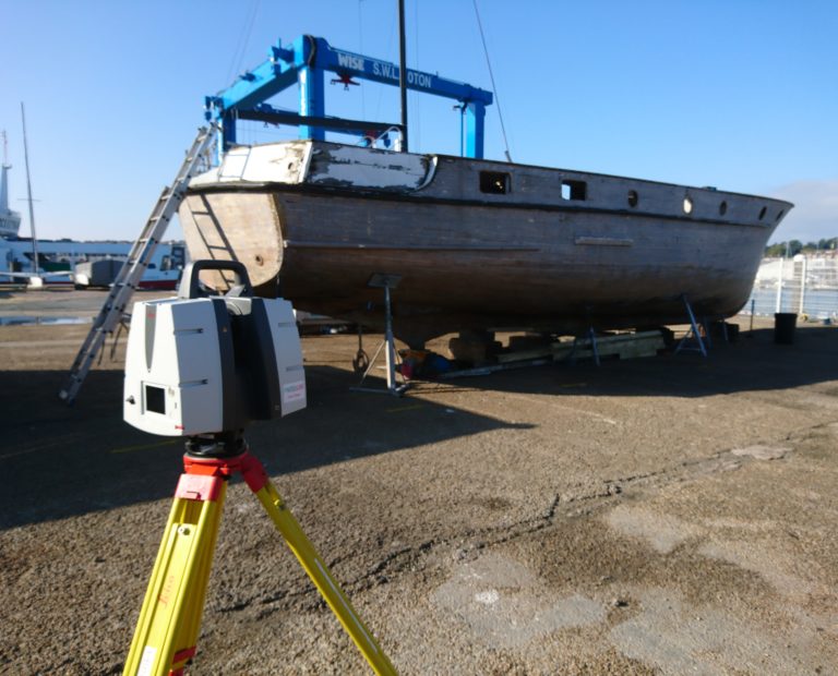
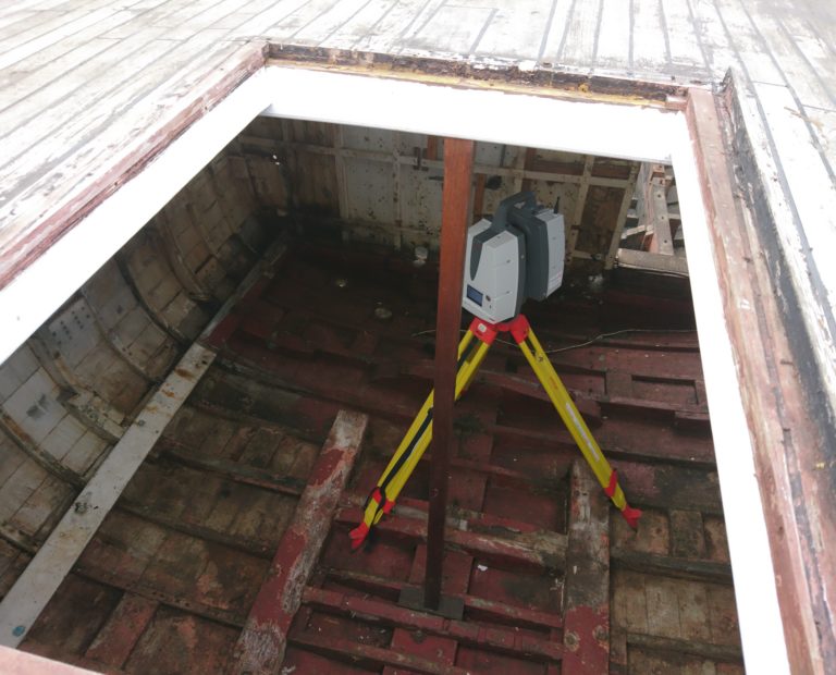
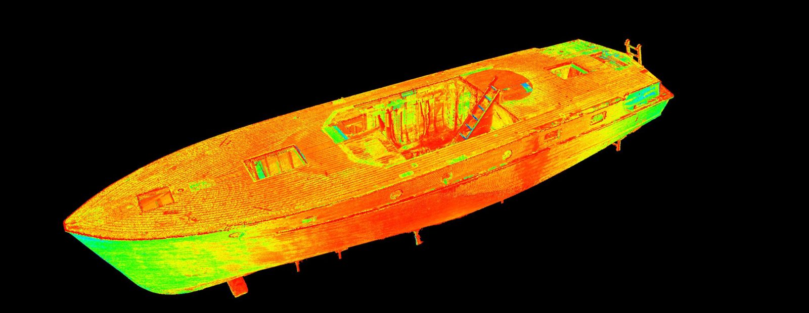
GEOSIGHT are specialists in 3D laser scanning which is carried out wherever there is a need to capture high resolution dimension data to produce a fully geo-referenced 3D model of a vessel or any physical structure.
The primary application for high resolution 3D laser capture is to model components and structures both internally and externally creating the basis for traditional drawings or a 3D model as an input to a VIM project.
Marine Engineering and VIM Services PDF Contact UsMetrology Surveys
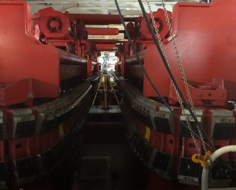
GEOSIGHT metrology surveys can deliver sub-millimetre accuracy using an optical 3D Coordinate Measurement Machine (CMM). Optical CMM provides a series of 3D coordinates of pre-targeted points, which can then be used for analysis against a design or used to construct surface models for reverse engineering purposes.
Methods
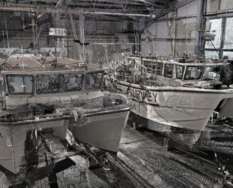
GEOSIGHT have developed hybrid techniques to merge different categories of survey equipment to provide unified datasets for our clients. We can tailor our services to any size of vessel, enabling us to produce relative sub-millimetre accuracy whilst maintaining millimetre accuracy over the full length of a vessel. Through this we can deliver accurate dimensional control information specifically tailored for the project.
Photos
Work
Vessel Information Modelling
View project
